National Authority
for the Litani River
for the Litani River
National Authority
for the Litani River
_1.jpg)

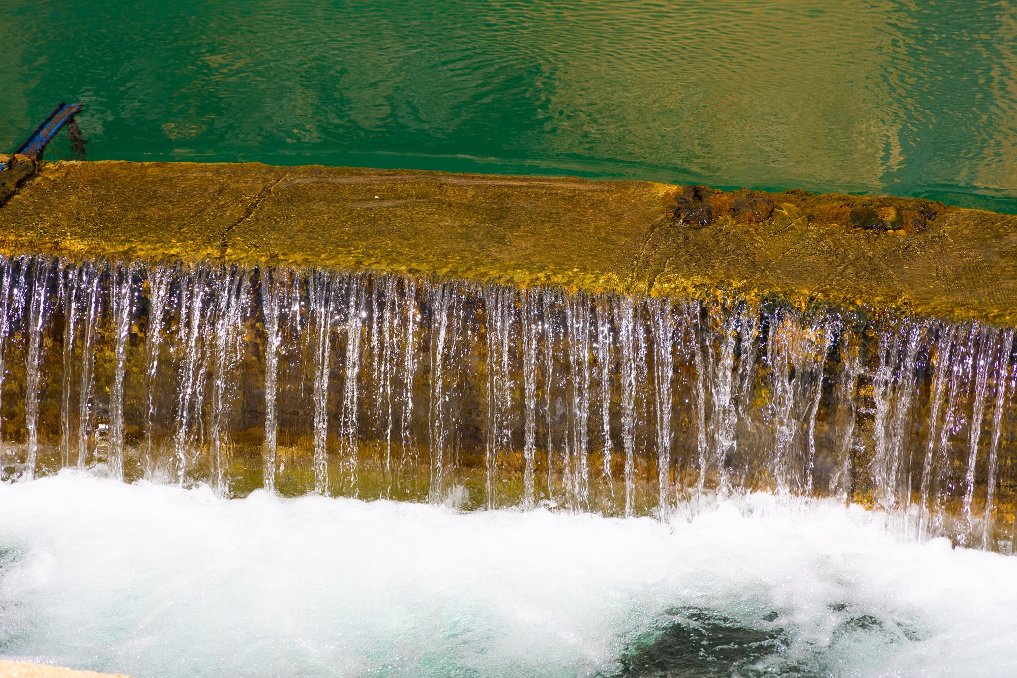
Cumulative hydropower production during the year 2026 (KWh)
The total electrical energy generated at the LRA HPPs from the beginning of 2026 through the end of April 2026 was approximately 86993000 KWh.
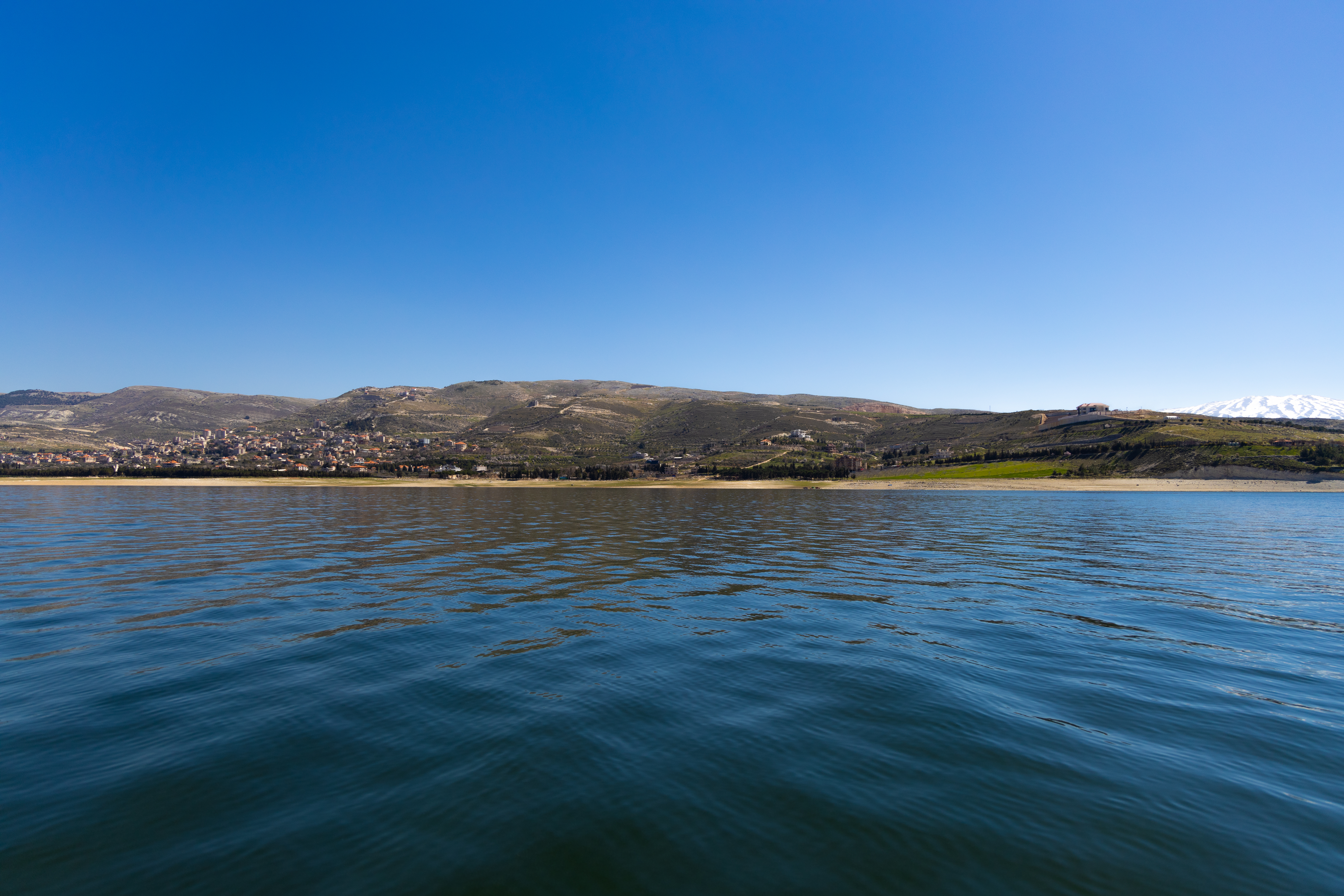
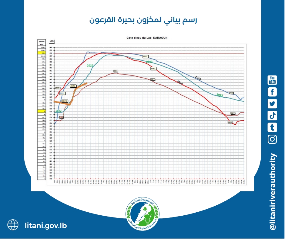
Qaraoun Lake - water level m
Water level in the dam above sea level
30 - April - 2026
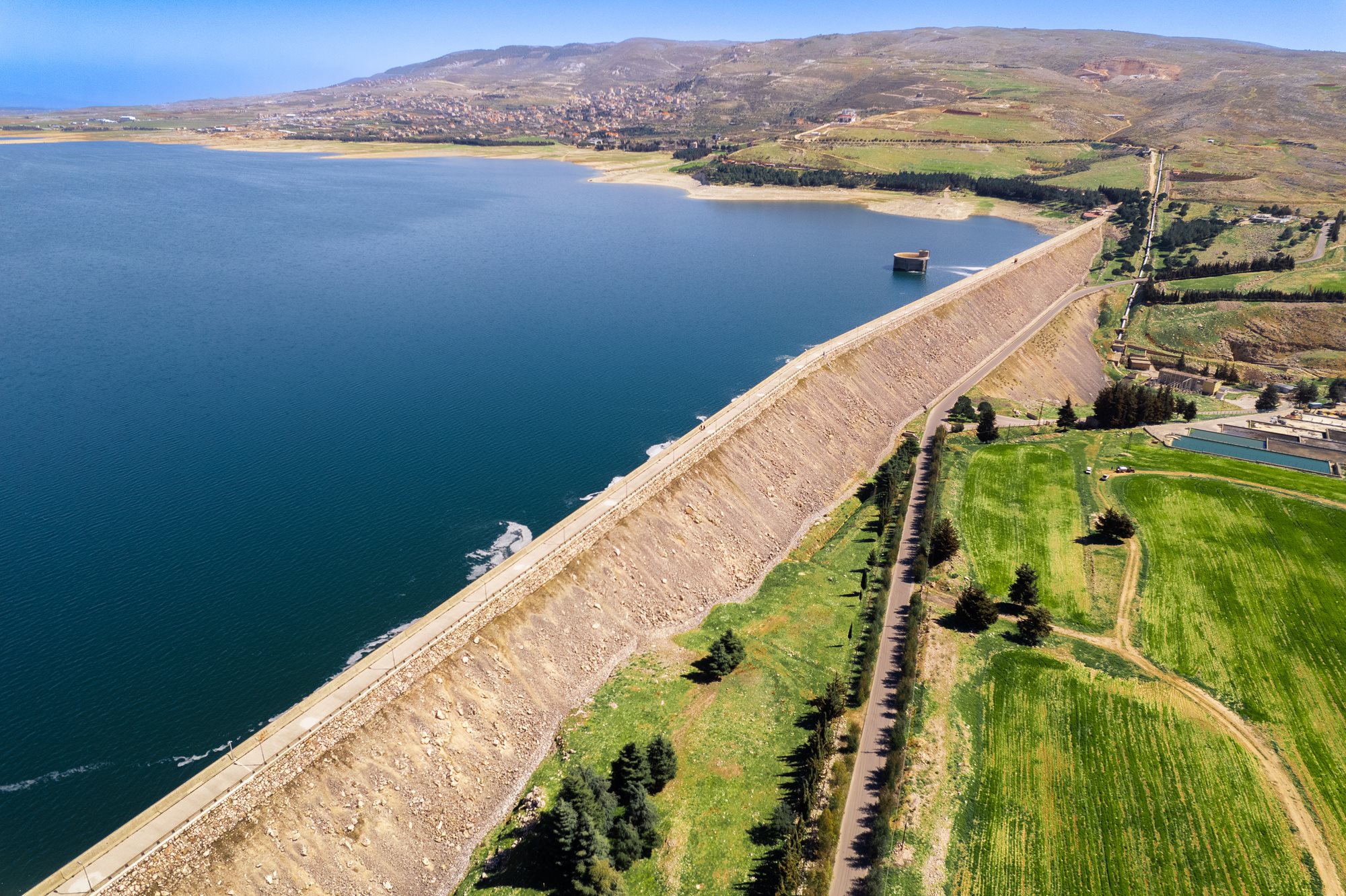
Qaraoun Lake - water stock m3
The water supply at the Qaroun Lake
30 - April - 2026
03 April 2026
تعلن المصلحة الوطنية لنهر الليطاني أنه، ومع ارتفاع الطلب على مياه الري من قبل مزارعي البطيخ في المناطق المستفيدة من مشروع ري القاسمية – رأس العين، قامت فرقها الفنية اليوم بزيادة كمية المياه المتدفقة من برك رأس العين باتجاه قناة رأس العين الجنوبية، وذلك استجابةً للحاجات الزراعية الملحّة وتأميناً لاستمرارية الموسم الزراعي.
وتؤكد المصلحة أنّها، رغم الأوضاع الأمنية الدقيقة في جنوب مدينة صور، تواصل تشغيل المقاطع الممكنة والآمنة من مشروع ري القاسمية – رأس العين، بما يضمن تلبية حاجات المزارعين ضمن الإمكانات الفنية والظروف الميدانية المتاحة، وبما يحافظ على استمرارية الخدمة العامة الزراعية وعدم تعريض المنشآت أو العاملين لأي مخاطر غير محسوبة.
كما تشدد المصلحة على أن فرقها الفنية والإدارية تتابع ميدانياً أوضاع التشغيل والتوزيع، وتعمل على تلبية طلبات المزارعين تباعاً وفق الأولويات الزراعية والحاجات الفعلية للمزروعات، ولا سيما الزراعات الصيفية التي تتطلب كميات إضافية من المياه في هذه المرحلة.
وتجدد المصلحة الوطنية لنهر الليطاني التزامها الكامل بدعم صمود القطاع الزراعي في الجنوب، ومواصلة إدارة واستثمار منشآت الري التابعة لها بما يخدم المزارعين ويحافظ على استمرارية الإنتاج الزراعي، ضمن ما تسمح به الظروف الراهنة.
21 July 2025
The Litani River Authority is publishing the Labor Management Procedures (LMP) document, which outlines the key labor-related requirements and the associated risks under the rehabilitation project for the Litani hydropower plants, funded through a loan from the World Bank.
This document provides a clear and systematic framework for addressing labor-related matters in line with the World Bank’s Environmental and Social Standards, specifically Environmental and Social Standard No. 2 (ESS2) concerning labor and working conditions.
🔗 You can access the document at the following link:
https://litani.gov.lb/en-us/aboutlra/worldbankagreement
.jpeg?ext=.jpeg)
12 July 2025
بعدما تمّ رصد تسرب كبير للمياه من المأخذ رقم ٣٢ في منطقة البرغلية – قضاء صور، نتيجة كسر في القساطل والقنوات الفرعية، أقدمت المصلحة على إقفال المأخذ لعدة أيام، بهدف الحد من الهدر وضغط المزارعين المعنيين لتصليح الأعطال.
وقد استجاب اليوم المزارعون المستفيدون من هذا المأخذ، فبادروا إلى تنفيذ أعمال الصيانة المطلوبة، شملت إصلاح القساطل المتضررة وإعادة تأهيل القنوات الفرعية، بما يضمن استئناف توزيع المياه بشكل منظم وفعّال.
وتؤكد المصلحة استمرارها في متابعة أعمال التشغيل والصيانة، بما يكفل حسن استخدام الموارد المائية ووقف الهدر وتحقيق العدالة في التوزيع.
04 March 2025
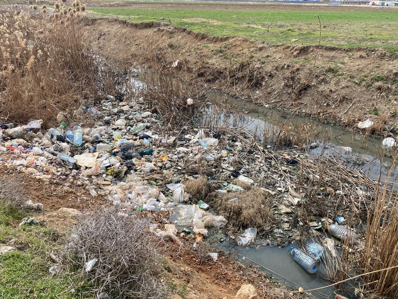
Within the framework of the efforts of the Litani River Authority to reduce pollution of the Litani River and limit the phenomenon of establishing camps for displaced people on the banks of the Litani River, LRA will begin taking legal measures aimed at prosecuting the owners of real estate properties invested and rented as camps for the syrian refugees.
In this context, the Authority filed a lawsuit against both "Hamad Al-Fadani" and "Ahmad Mohsen Suleiman" for establishing camps for syrian displaced people on their properties in the Badnayel Real Estate and Al-Muallaqa Real Estate areas.
These camps contribute directly to the pollution of the Litani River, which constitutes a blatant environmental and legal violation. The refugees throw everything produced by the camp, including sewage and solid waste, directly into the Litani River.
In addition to installing many pipes to pass the drainage and waste directly to the river, and forming another path in the form of a canal that also transports the drainage and waste to the river from the other side.
The service teams of LRA also monitored the presence of a place for raising goats directly on the banks of the river, where animal waste and resulting dirt are transferred through the pipes connected to the Litani River, which exacerbates the pollution problem.
This pollution and others do not only affect the quality of the water, but also lead to soil pollution and deterioration of air quality due to bad odors and emissions resulting from this type of waste.
The resulting pollution poses a direct threat to the health of local residents and displaced persons alike.. as it causes the spread of epidemics, infectious diseases and chronic health problems.. More over, to the negative effects on the ecosystem that may lead to the destruction of natural resources in the region, which in turn negatively affects economic activities such as agriculture and fishing.
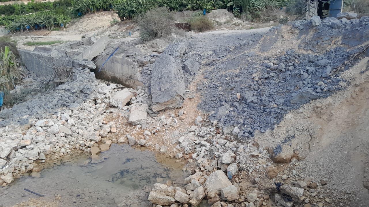
21 December 2024
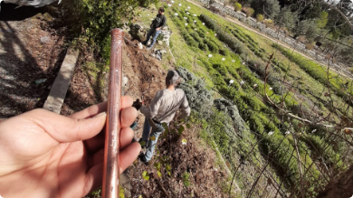
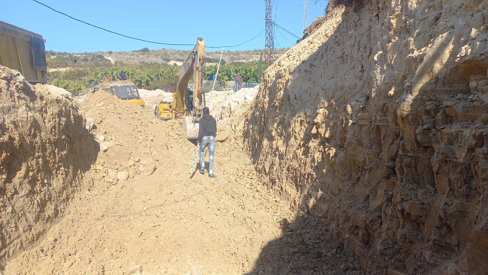
After the war launched by the Israeli enemy on Lebanon, which included an airstrike on October 8 targeting the main carrier of the Qasimiyah and Ras al-Ain irrigation canal project in the Arzi area, causing severe damage to the carrier with a length of approximately 65 m, including a 6 m water culvert, and after inspecting and identifying the damage, Danesh Contracting and Trading Company took the initiative to implement the 6 m long culvert, dig and remove the damage to the carrier, and prepare the land with Typhenol for a length of 50 m at its own expense. The Authority will conduct a tender to award the remaining works to rehabilitate the carrier as soon as possible so that the irrigation canal is ready to drain water into it to feed the agricultural lands benefiting from the canal before the start of the 2025 irrigation season.
For more photos:
18 November 2024
Due to the onset of heavy rains, and to prevent the flooding of the canal waters on the orchards and neighboring lands, the National Litani River Authority took urgent measures to divert water at the Zrarieh diversion dam towards the Litani River.
LRA's teams also smuggled water from the canal in several locations, including the Abu Al-Aswad smuggling dam, the Asimiyah smuggling dam in the Sarafand area, in addition to the smuggling dams in the Aaqbieh, Zahrani and Ghazieh areas.
This step comes within the framework of LRA's efforts to preserve public and private property, and prevent rainwater from flooding on the orchards and neighboring roads, which contributes to reducing the damage that may be caused to farmers' lands and crops.
These measures demonstrate the National Litani River Authority's keenness to preempt any risks resulting from rising water levels, and to confirm its commitment to maintaining agricultural security and protecting water resources in the region, which contributes to ensuring the continuity of agricultural production.
_1.jpeg?ext=.jpeg)
10 November 2024
Despite the ongoing Israeli aggression on southern Lebanon, the Litani River Authority continues its diligent work to maintain the cleanliness of the filters and culverts and ensure the continuous flow of water along the Qasimiya Ras Al-Ain Irrigation Project.
LRA's team cleans the filters and culverts from the Matariya area all the way to the Ghazieh Real Estate area, then collects the dirt and transports it to the landfills approved by the Authority.
The filters and culverts were cleaned in several locations including Al-Wasta, Al-Kharayeb, Abu Al-Aswad, Al-Bissariya, Al-Aqbiyeh and Al-Masla (Ghazieh). These efforts come within the framework of LRA's keenness to prevent the blockage of filters, secure water for farmers and support vital projects in the region.
Despite the challenges and difficult circumstances, Litani River Authority remains committed to ensuring the flow of water along the project, which contributes to preserving citizens' crops.
13 October 2024
Statement issued by the National Litani River Authority:
In coordination with the Lebanese Army and the Intelligence Directorate in the South, the Litani River Authority's specialized technical teams, in the presence of the Head of the Investment and Maintenance Authority, Engineer Imad Terro, this morning, Sunday, October 13, 2024, and accompanied by elements of the Lebanese Army and with the participation of the Head of the Southern Farmers' Gathering, Engineer Mohammad Al-Husseini, inspected the main conveyor of the Qasimiya and Ras Al-Ain irrigation project in the Arzi area and the culverts leading to the main pumping station of the Qasimiya project, to determine the extent of the damage resulting from the raids launched by the Israeli enemy on these vital and civilian facilities on October 8.
The Litani River Authority announces that based on the results of the inspection, the maintenance teams began preparing the machinery, equipment and materials required to carry out temporary and urgent maintenance, especially for the main conveyor on the canal in the Arzi area, to restart the canal and supply it with water to enable farmers to irrigate their lands to preserve agricultural crops.
LRA also indicates that maintenance work is expected to begin as soon as possible after obtaining the required security approvals from the Lebanese Army and all other security agencies responsible for issuing special permits due to the security conditions in the country.
LRA affirms its commitment to providing water to subscribers despite the challenges and risks, considering that the water and agriculture sectors constitute the most prominent elements of steadfastness and protection of food security.
Finally, we extend our thanks to the Lebanese Army Command and the Intelligence Directorate, represented by the Head of the Army Intelligence Branch in the South, Brigadier General Suhail Harb, for facilitating and following up on this urgent and necessary mission to save thousands of hectares of agricultural land.

18 September 2024
The Syndicate of Employees and Workers of the National Authority of the Litani River announces its commitment to the statements of the General Labor Union and the Federation of Labor Unions for Independent Interests and Public Institutions, and its condemnation of the Israeli aggression against the Lebanese, which exceeded all human standards and values, as it amounts to a war crime that requires international bodies and courts to move towards prosecuting the criminal leaders of the entity. The Syndicate announces that Wednesday - September 18, 2024 - is a strike day in solidarity with the bereaved and wounded, and in mourning for the martyrs, with the exception of workers in energy production plants and pumping stations and a number of administrators working on completing salaries and wages at the main office of the Authority.
With patience, steadfastness and good management, we overcome hardships, and with unity we win.
Syndicate Council.
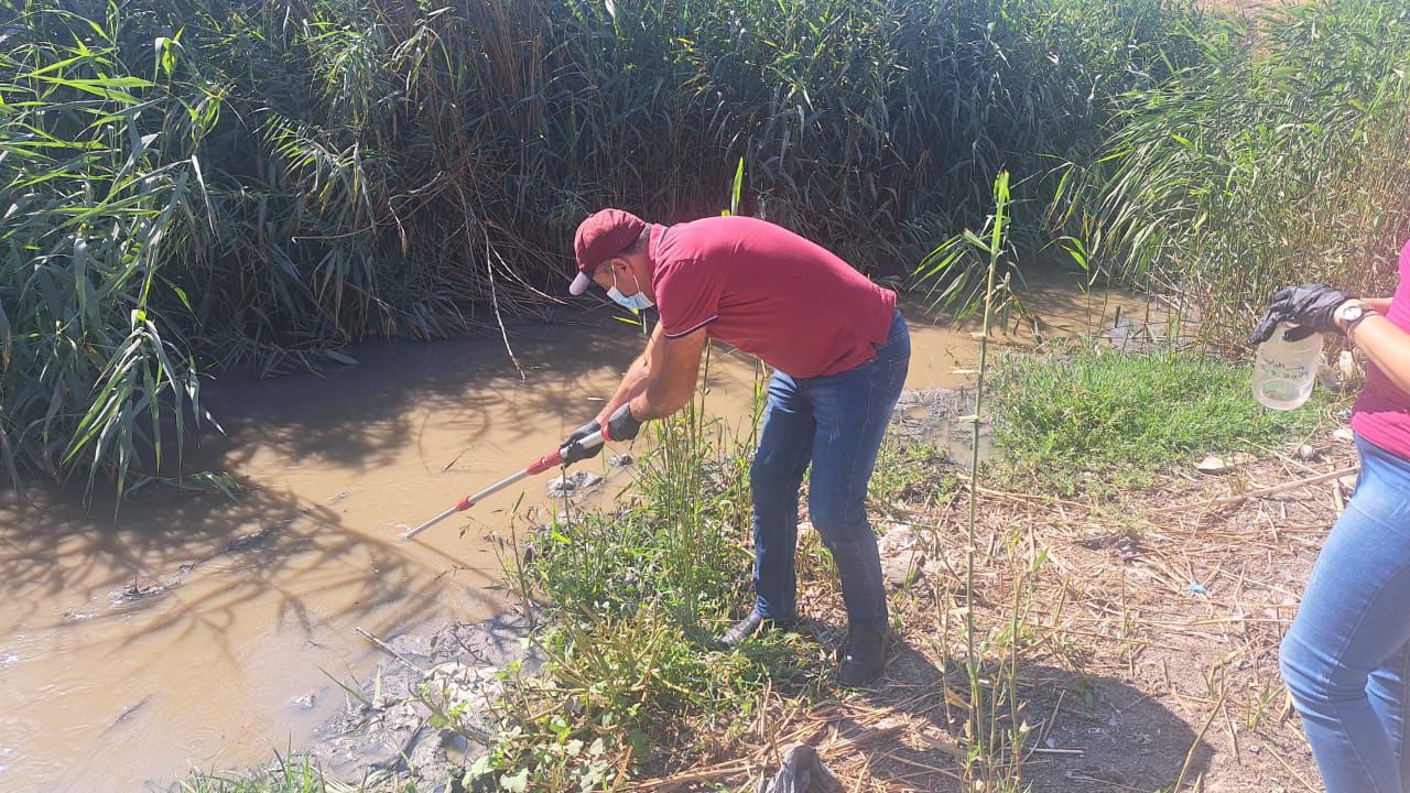
13 September 2024
The National Litani River Authority announced the detection of cholera bacteria in the waters of the Litani River in the upper basin during its periodic examinations of samples from random and pre-specified locations of the Litani River waters.
The Authority indicated that water contaminated with cholera bacteria is the most important reason for its spread, especially since the Litani River, especially in its upper basin, still receives untreated sewage contaminated with various types of bacteria.
On September 9, 2024, the National Litani River Authority took water samples from 7 points in the Litani River in its upper basin to monitor any cholera contamination, and these samples were analyzed in the Authority's laboratory in Khirbet Qanafar.
The results showed that the water was contaminated with cholera bacteria at two points: the sewage collection point in Chtaura and the Litani River point at the Dalhamiya Bridge. It is worth noting that these two points also recorded cholera contamination when the epidemic broke out in 2022.
The Litani River Authority warns of the current situation of the river and requests the cessation of all activities that could exacerbate this situation or lead to a new outbreak of the epidemic, as once the cholera germ reaches the surface water, it will spread and spread to all points, which carries a serious health risk that threatens all the people of the upper Litani River basin.
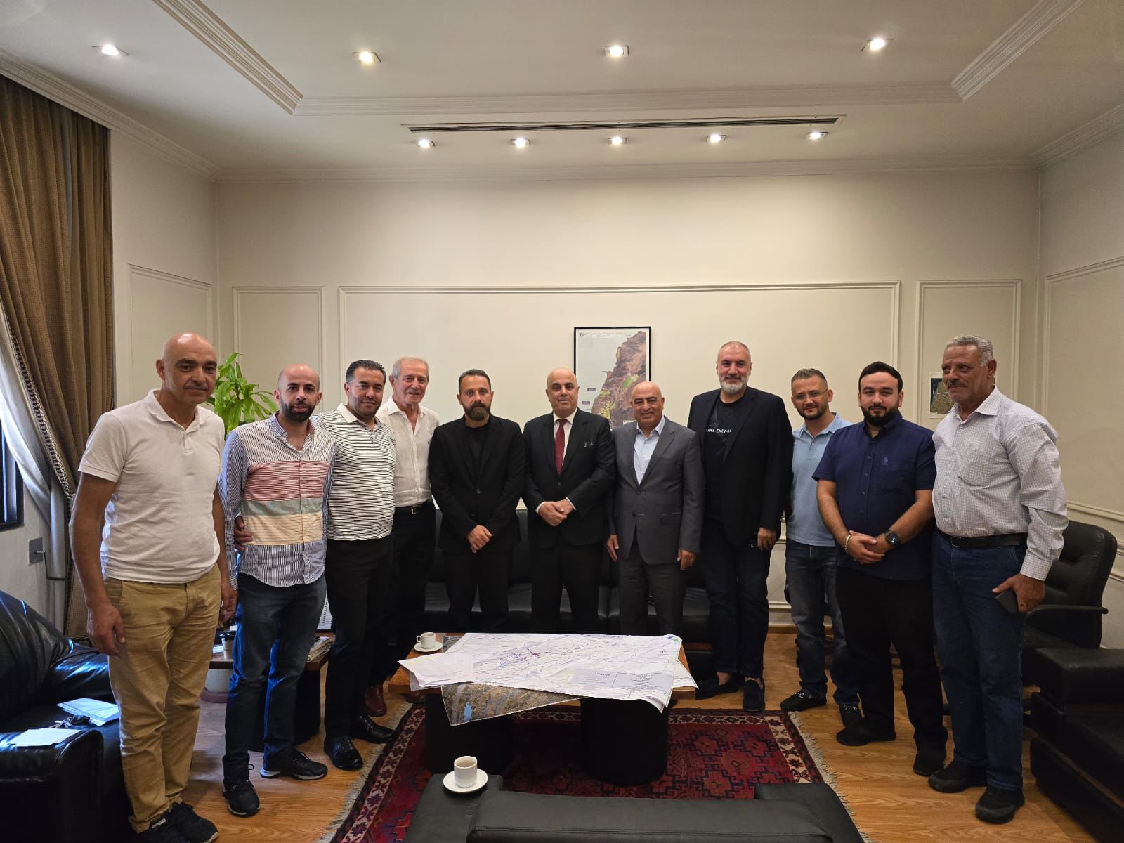
04 September 2024
On September 3, 2024, the head of the Litani River National Authority, Dr. Sami Alawieh, received a delegation of industrial establishments located in the upper basin of the Litani River, headed by the head of the Industrialists' Association in the Bekaa, Mr. Nicola Abu Faisal, where the attendees provided an explanation of the environmental issues related to their establishments.
During this meeting, it was decided to form a joint technical committee between the Litani River National Authority and industrialists in order to determine the treatment principles in light of technical expertise and previous experiences. The Litani River National Authority expressed its readiness to assist all industrialists in improving the treatment of polluted water resulting from their factories and protecting the Litani River from industrial pollution through this joint committee. It also praised the industrialists who are fully prepared to treat water inside their factories and focused on the need to continue treatment and operation of stations to avoid any additional pollution.

11 August 2024
On August 5, 2024, and upon the assignment of the sole criminal judge in Zahle, expert Carol Sakhn, along with the technical teams of the National Litani River Authority, revisited 3 industrial establishments, namely Hajjar Food Factory, Chateau Kherbet Qanafar, and Alpha Interfood Factory, to take samples of the treated industrial water in the aforementioned establishments and evaluate the effectiveness of the treatment.
The expert and the technical teams of the Authority also took samples from two hospitals, namely Chtaura Hospital and Rayak Hospital, at their request after they reported that the treatment plants had achieved the required effectiveness.
.png)


The Department of Geographic Information Systems (GIS) performs tasks aimed at creating a database for the data set and documenting all information related to the Litani River Basin and issuing the necessary and illustrative maps for the river basin and for the projects of the National Authority for the Litani River, including (a comprehensive survey of all institutions located in the river basin, significant projects to treat pollution In the Litani River basin, irrigation canals, irrigated areas, interest properties, river properties...) and then building a geographic information base.