
National Authority
for the Litani River
for the Litani River
National Authority
for the Litani River
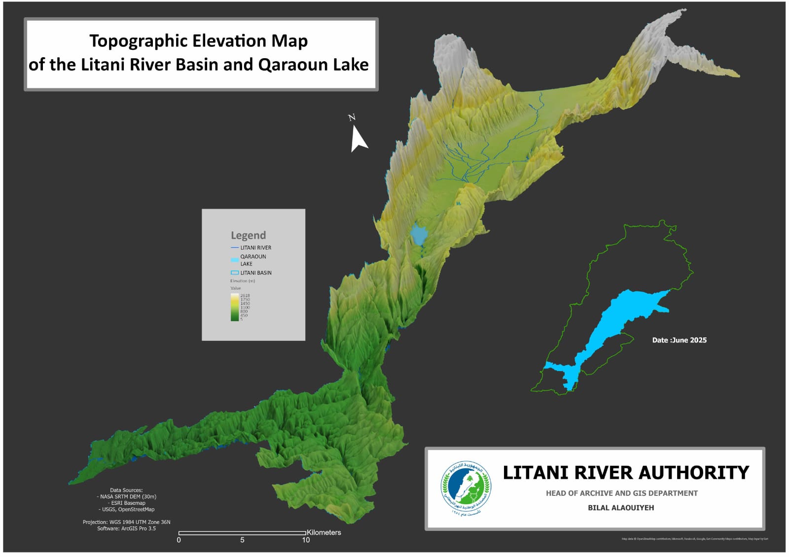
This topographic elevation map displays the geomorphological characteristics of the Litani River basin and Lake Qaraoun, produced using the NASA SRTM digital elevation model with a 30-meter resolution, and processed using ArcGIS Pro 3.5.
The map provides a visual representation of elevation gradients, highlighting watershed boundaries and terrain diversity, which is crucial for hydrological modeling, watershed management, and environmental planning. These outputs contribute to the ongoing efforts to understand freshwater systems in Lebanon, with implications for sustainable water resource governance and enhancing the region's resilience to climate change.